| Coast and Beach |
||
 |
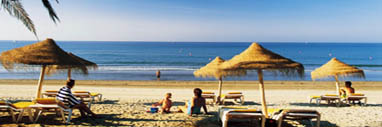
Beach |
|
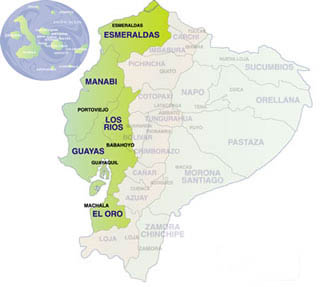
The Ecuadorian Pacific coast and western lowlands locally known as "la costa" is formed by the following densely populated provinces, from north to south: Esmeraldas, Manabí, Los Ríos, Guayas and El Oro. The Coast covers about 70'000 qkm, less than one third of the surface of Ecuador, but 50 % of the population live in this region, mainly in and around the city of Guayaquil, the pulsing and modern major business and economic center and main port of Ecuador. The average temperature is 24°C (18ºC to 30ºC); the climate is very much influenced by the ocean currents El Niño (warm) and Humbold (cold). The warm and humid rainy season (winter) lasts from December to May, and the cooler und less humid dry season (summer) from June to December. This influence has led to three dominant ecosystems on the coastline: the tropical rain forest in the north, tropical savannas and cloudforest in the center and southwest, and a dry forest on the peninsula of Sta. Elena. [PayPal Button Here] |
||